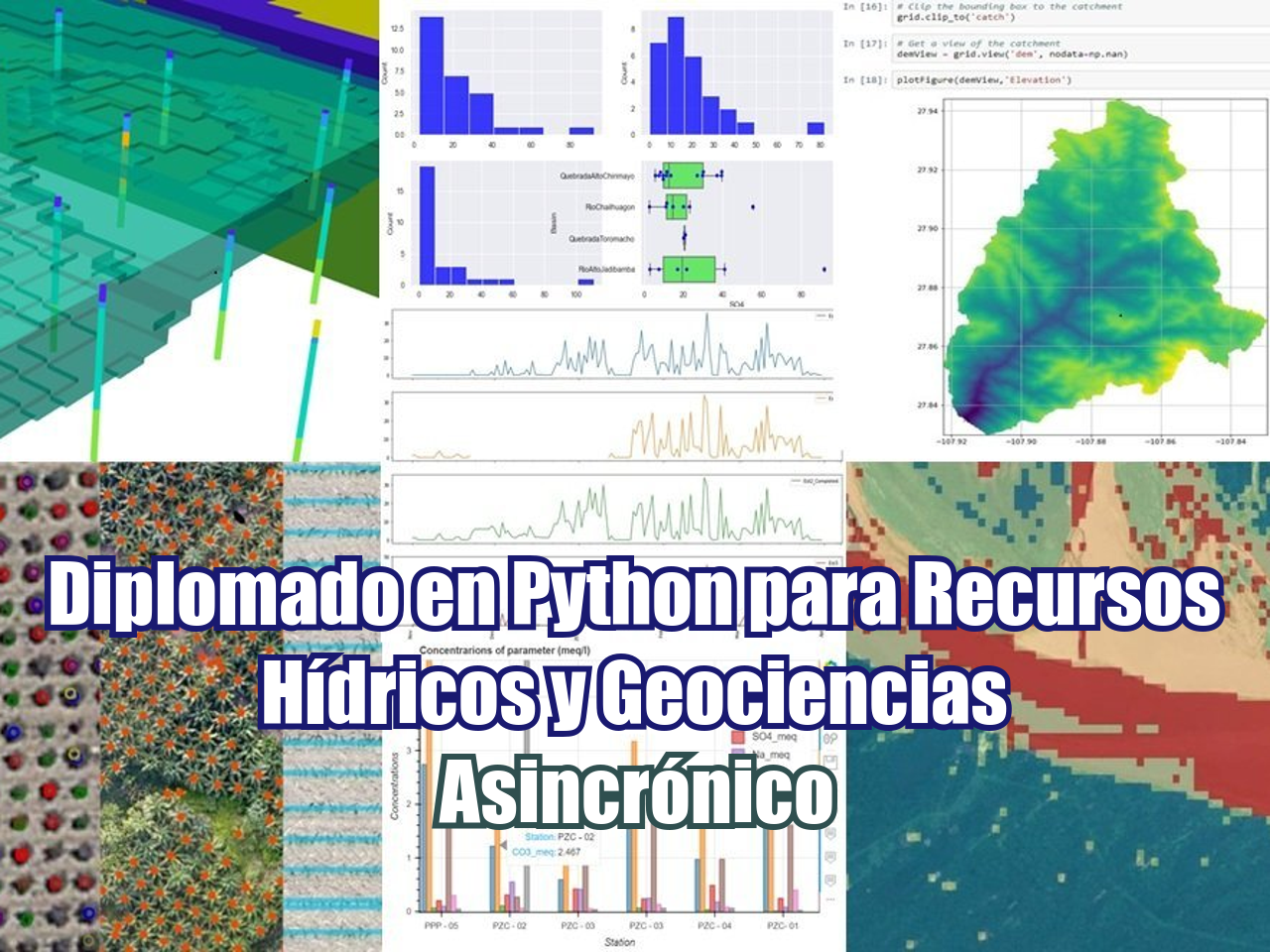
Los geocientíficos necesitan la mejor estimación del entorno geológico para realizar simulaciones o evaluaciones. Además de conocimiento geológico, la construcción de modelos geológicos también requiere un conjunto completo de métodos matemáticos como redes bayesianas, Cokrigging, SVM, redes neuronales, modelos estocásticos para definir cuál podría ser el tipo / propiedad de roca cuando la información de los registros de perforación o geofísica es realmente escasa o incierta.
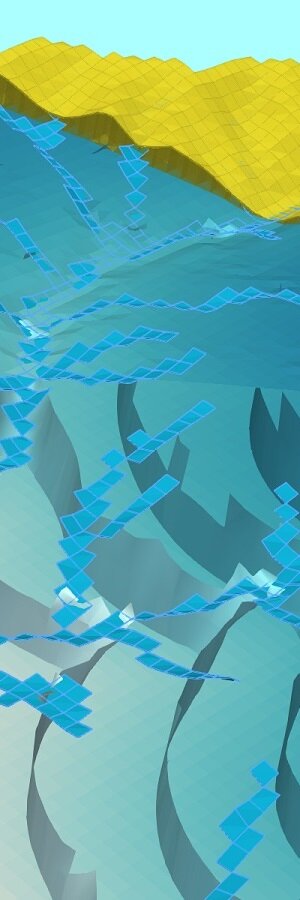
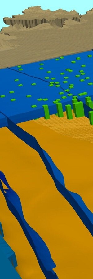
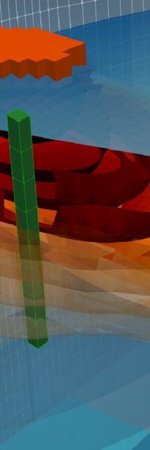
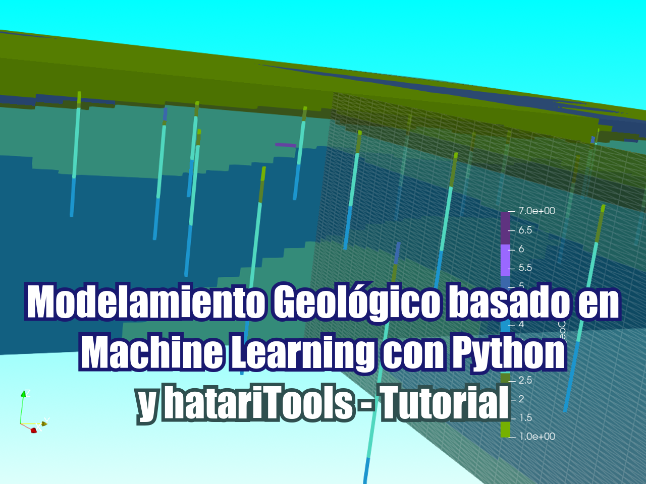
Hemos realizado un tutorial en Python con bibliotecas recientes y potentes como Scikit Learn para crear un modelo geológico basado en la litología de perforaciones en Treasure Valley (Idaho, EE. UU.). El tutorial genera una nube de puntos de litologías que se transforman y escalan para la red neuronal. El clasificador de red neuronal seleccionado es un clasificador de Perceptrón multicapa implementado en la biblioteca Scikit Learn como sklearn.neural_network.MLPClassifier. Se realiza una matriz de confusión de la red neuronal. El tutorial también incluye una visualización 3D georreferenciada de litología de pozos y geología interpolada como formato Vtk en Paraview.
Video
Código
Este es el código completo en Python utilizado en este tutorial:
#import required libraries
%matplotlib inline
import os
import numpy as np
import pandas as pd
import matplotlib.pyplot as plt
import pyvista as pv
import vtk
Import well location and lithology
From the publicacion: https://pubs.usgs.gov/sir/2019/5138/sir20195138_v1.1.pdf The selected units would be:
- Coarse-grained fluvial and alluvial deposits
- Pliocene-Pleistocene and Miocene basalts
- Fine-grained lacustrine deposits
- Rhyolitic and granitic bedrock
wellLoc = pd.read_csv('../inputData/TV-HFM_Wells_1Location_Wgs11N.csv',index_col=0)
wellLoc.head()| Easting | Northing | Altitude_ft | EastingUTM | NorthingUTM | Elevation_m | |
|---|---|---|---|---|---|---|
| Bore | ||||||
| A. Isaac | 2333140.95 | 1372225.65 | 3204.0 | 575546.628834 | 4.820355e+06 | 976.57920 |
| A. Woodbridge | 2321747.00 | 1360096.95 | 2967.2 | 564600.366582 | 4.807827e+06 | 904.40256 |
| A.D. Watkins | 2315440.16 | 1342141.86 | 3168.3 | 558944.843404 | 4.789664e+06 | 965.69784 |
| A.L. Clark; 1 | 2276526.30 | 1364860.74 | 2279.1 | 519259.006159 | 4.810959e+06 | 694.66968 |
| A.L. Clark; 2 | 2342620.87 | 1362980.46 | 3848.6 | 585351.150270 | 4.811460e+06 | 1173.05328 |
wellLito = pd.read_csv('../inputData/TV-HFM_Wells_2Lithology_m_rcl_clip.csv',index_col=0)
wellLito.head()| Bore | Depth_top_L | Depth_bot_L | PrimaryLith | topLitoElev_m | botLitoElev_m | litoCode | hydrogeoCode | |
|---|---|---|---|---|---|---|---|---|
| 1309 | H. Raff | 0.0 | 1.0 | Soil | 770.44296 | 770.13816 | 0 | 1 |
| 1310 | H. Raff | 1.0 | 6.0 | Clay | 770.13816 | 768.61416 | 7 | 3 |
| 1311 | H. Raff | 6.0 | 12.0 | Gravel | 768.61416 | 766.78536 | 6 | 1 |
| 1312 | H. Raff | 12.0 | 18.0 | Clay | 766.78536 | 764.95656 | 7 | 3 |
| 1313 | H. Raff | 18.0 | 48.0 | Gravel | 764.95656 | 755.81256 | 6 | 1 |
Point cloud of lithologies
litoPoints = []

for index, values in wellLito.iterrows():
    wellX, wellY, wellZ = wellLoc.loc[values.Bore][["EastingUTM","NorthingUTM","Elevation_m"]]
    wellXY = [wellX, wellY]
    litoPoints.append(wellXY + [values.topLitoElev_m,values.hydrogeoCode])
    litoPoints.append(wellXY + [values.botLitoElev_m,values.hydrogeoCode])

    litoLength = values.topLitoElev_m - values.botLitoElev_m
    if litoLength < 1:
        midPoint = wellXY + [values.topLitoElev_m - litoLength/2,values.hydrogeoCode]
    else:
        npoints = int(litoLength)
        for point in range(1,npoints+1):
            disPoint = wellXY + [values.topLitoElev_m - litoLength*point/(npoints+1),values.hydrogeoCode]
            litoPoints.append(disPoint)
litoNp=np.array(litoPoints)
np.save('../outputData/litoNp',litoNp)
litoNp[:5]
array([[5.48261389e+05, 4.83802316e+06, 7.70442960e+02, 1.00000000e+00],
[5.48261389e+05, 4.83802316e+06, 7.70138160e+02, 1.00000000e+00],
[5.48261389e+05, 4.83802316e+06, 7.70138160e+02, 3.00000000e+00],
[5.48261389e+05, 4.83802316e+06, 7.68614160e+02, 3.00000000e+00],
[5.48261389e+05, 4.83802316e+06, 7.69376160e+02, 3.00000000e+00]])Coordinate transformation and Neural Network Classifier setup
from sklearn.neural_network import MLPClassifier
from sklearn.metrics import confusion_matrix
from sklearn import preprocessing
litoX, litoY, litoZ = litoNp[:,0], litoNp[:,1], litoNp[:,2]
litoMean = litoNp[:,:3].mean(axis=0)
litoTrans = litoNp[:,:3]-litoMean
litoTrans[:5]
#setting up scaler
scaler = preprocessing.StandardScaler().fit(litoTrans)
litoScale = scaler.transform(litoTrans)
#check scaler
print(litoScale.mean(axis=0))
print(litoScale.std(axis=0))[ 2.85924590e-14 -1.10313442e-15 3.89483608e-20]
[1. 1. 1.]#run classifier
X = litoScale
Y = litoNp[:,3]
clf = MLPClassifier(activation='tanh',solver='lbfgs',hidden_layer_sizes=(15,15,15), max_iter=2000)
clf.fit(X,Y)C:\Users\Gida\Anaconda3\lib\site-packages\sklearn\neural_network\_multilayer_perceptron.py:470: ConvergenceWarning: lbfgs failed to converge (status=1):
STOP: TOTAL NO. of ITERATIONS REACHED LIMIT.
Increase the number of iterations (max_iter) or scale the data as shown in:
https://scikit-learn.org/stable/modules/preprocessing.html
self.n_iter_ = _check_optimize_result("lbfgs", opt_res, self.max_iter)
MLPClassifier(activation='tanh', alpha=0.0001, batch_size='auto', beta_1=0.9,
beta_2=0.999, early_stopping=False, epsilon=1e-08,
hidden_layer_sizes=(15, 15, 15), learning_rate='constant',
learning_rate_init=0.001, max_fun=15000, max_iter=2000,
momentum=0.9, n_iter_no_change=10, nesterovs_momentum=True,
power_t=0.5, random_state=None, shuffle=True, solver='lbfgs',
tol=0.0001, validation_fraction=0.1, verbose=False,
warm_start=False)Determination of confusion matrix
numberSamples = litoNp.shape[0]
expected=litoNp[:,3]
predicted = []
for i in range(numberSamples):
    predicted.append(clf.predict([litoScale[i]]))
results = confusion_matrix(expected,predicted)
print(results)
[[1370 128 377 0]
[ 67 2176 10 0]
[ 274 33 1114 0]
[ 1 0 0 151]]Area of study and output grid refinement
xMin = 540000
xMax = 560000
yMin = 4820000
yMax = 4840000
zMax = int(wellLito.topLitoElev_m.max())
zMin = zMax - 300
cellH = 200
cellV = 20Determination of the lithology matrix
vertexCols = np.arange(xMin,xMax+1,cellH)
vertexRows = np.arange(yMax,yMin-1,-cellH)
vertexLays = np.arange(zMax,zMin-1,-cellV)
cellCols = (vertexCols[1:]+vertexCols[:-1])/2
cellRows = (vertexRows[1:]+vertexRows[:-1])/2
cellLays = (vertexLays[1:]+vertexLays[:-1])/2
nCols = cellCols.shape[0]
nRows = cellCols.shape[0]
nLays = cellLays.shape[0]
i=0
litoMatrix=np.zeros([nLays,nRows,nCols])
for lay in range(nLays):
for row in range(nRows):
for col in range(nCols):
cellXYZ = [cellCols[col],cellRows[row],cellLays[lay]]
cellTrans = cellXYZ - litoMean
cellNorm = scaler.transform([cellTrans])
litoMatrix[lay,row,col] = clf.predict(cellNorm)
if i%30000==0:
print("Processing %s cells"%i)
print(cellTrans)
print(cellNorm)
print(litoMatrix[lay,row,col])
i+=1Processing 0 cells
[-8553.96427073 8028.26104284 356.7050941 ]
[[-1.41791371 2.42904321 1.11476509]]
3.0
Processing 30000 cells
[-8553.96427073 8028.26104284 296.7050941 ]
[[-1.41791371 2.42904321 0.92725472]]
3.0
Processing 60000 cells
[-8553.96427073 8028.26104284 236.7050941 ]
[[-1.41791371 2.42904321 0.73974434]]
3.0
Processing 90000 cells
[-8553.96427073 8028.26104284 176.7050941 ]
[[-1.41791371 2.42904321 0.55223397]]
2.0
Processing 120000 cells
[-8553.96427073 8028.26104284 116.7050941 ]
[[-1.41791371 2.42904321 0.3647236 ]]
2.0plt.imshow(litoMatrix[0])<matplotlib.image.AxesImage at 0x14fb8688860>plt.imshow(litoMatrix[:,60])
<matplotlib.image.AxesImage at 0x14fb871d390>np.save('../outputData/litoMatrix',litoMatrix)
#matrix modification for Vtk representation
litoMatrixMod = litoMatrix[:,:,::-1]
np.save('../outputData/litoMatrixMod',litoMatrixMod)
plt.imshow(litoMatrixMod[0])
<matplotlib.image.AxesImage at 0x14fb87825f8>Generation of regular grid VTK
import pyvista
import vtk

# Create empty grid
grid = pyvista.RectilinearGrid()

# Initialize from a vtk.vtkRectilinearGrid object
vtkgrid = vtk.vtkRectilinearGrid()
grid = pyvista.RectilinearGrid(vtkgrid)
grid = pyvista.RectilinearGrid(vertexCols,vertexRows,vertexLays)

litoFlat = list(litoMatrixMod.flatten(order="K"))[::-1]
grid.cell_arrays["hydrogeoCode"] = np.array(litoFlat)
grid.save('../outputData/hydrogeologicalUnit.vtk')
